Lunsar
Lunsar is a town in Marampa Chiefdom, Port Loko District in the Northern Province of Sierra Leone. It is the largest town in Port Loko District by population. The Britannica estimate of the population of Lunsar is 36,108. The town is one of the main commercial and business hub in the North of Sierra Leone. Lunsar lies approximately 50 miles east of Freetown and about 18 miles south-east of the district capital of Port Loko. The inhabitants of Lunsar are largely from the Temne ethnic group.
Its most recent history has been an iron ore mining town. The ore, for the most part, is set in stone which forms a huge mountain, called Massaboin Hill. The word stone in the local Temne language is "Sar," and thus befits the area where the iron ore was found. Thus, the town's initial name was "Ro-Sar" meaning the place where the stones are found. Ro-sar later evolved to Lunsar during the colonial era.
Its most recent history has been an iron ore mining town. The ore, for the most part, is set in stone which forms a huge mountain, called Massaboin Hill. The word stone in the local Temne language is "Sar," and thus befits the area where the iron ore was found. Thus, the town's initial name was "Ro-Sar" meaning the place where the stones are found. Ro-sar later evolved to Lunsar during the colonial era.
Map - Lunsar
Map
Country - Sierra_Leone
 |
 |
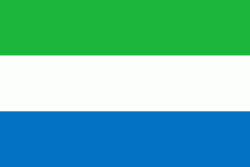
| Flag of Sierra Leone | |
It is a constitutional republic with a unicameral parliament and a directly elected president serving a five-year term with a maximum of two terms. It is a secular nation with the constitution providing for the separation of state and religion and freedom of conscience (which includes freedom of thoughts and religion). Muslims make up about three-quarters of the population, with a Christian minority.
Currency / Language
| ISO | Currency | Symbol | Significant figures |
|---|---|---|---|
| SLL | Sierra Leonean leone | Le | 2 |
| ISO | Language |
|---|---|
| EN | English language |


